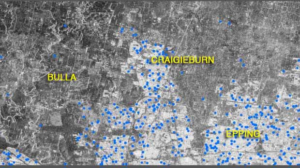
Satellite images are being used to help detect leaking water mains as part of a Victorian-first trial supported by Western Water.
Initially developed to search for water on other planets, the technology involves photographs taken from 650 kilometres above the earth over several weeks.
Experts then analyse the images, laying them over maps of water networks to reveal pipes that may be leaking.
The state government trial, which covers more than 3000 square kilometres, also involves City West Water and Yarra Valley Water.
Validation of leak sites started last month after almost two months of photographic work.
Intelligent Water Networks chairman Neil Brennan, who is also Western Water managing director, said a preliminary report was likely to be handed to the government later this month.
‘‘If it meets the pilot objectives, it could have widespread benefits for the water industry and our customers,’’ he said.
State Water Minister Lisa Neville said millions of litres of precious drinking water could be saved.
‘‘This project is one of many currently under way to investigate how we can use new technologies for greater efficiency in the water industry,’’ she said.
Western Water estimates 460 million litres of water, valued at about $750,000, is lost to leaks in its region each year.


